
You know how I love old stones. Especially 2500 year old stones. I affirmatively seek them out in my geographical cures.
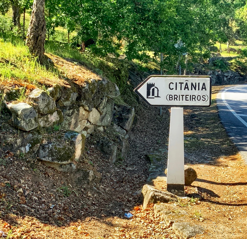
And you have to love them to get to northern Portugal’s Citânia de Briteiros. It’s not off the beaten path. It’s a bit out of the way. Or possibly unheard of by most humans. Including me, before I researched my northern Portugal trip.
The archaeological site sits at the very top of the boulder strewn hill of Saint Romão, accessed by a very long and winding road. I got rather carsick while driving there, a first for me.
Citânia is an obscure early Iron Age archaeological site in northern Portugal, about 9 miles from Guimarães. My daughter and I visited on a day trip from Porto.
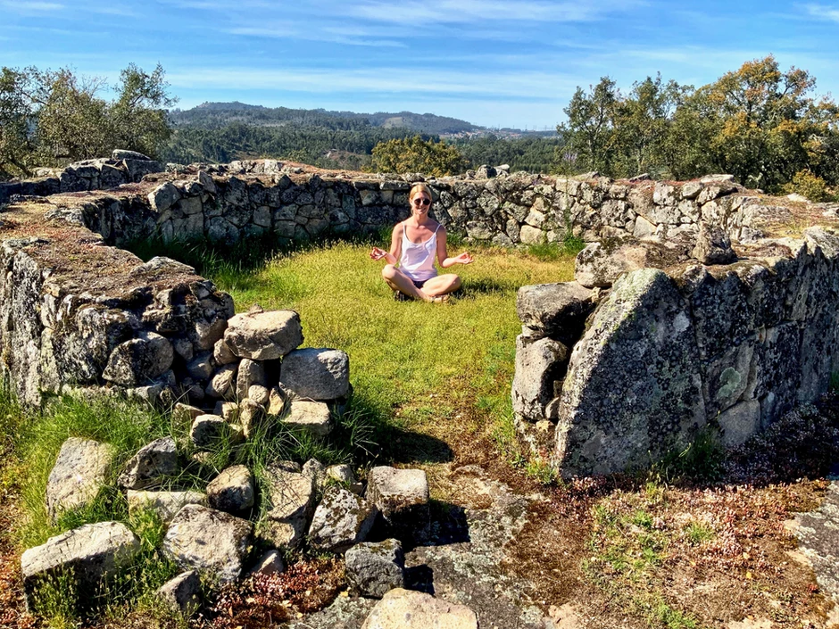
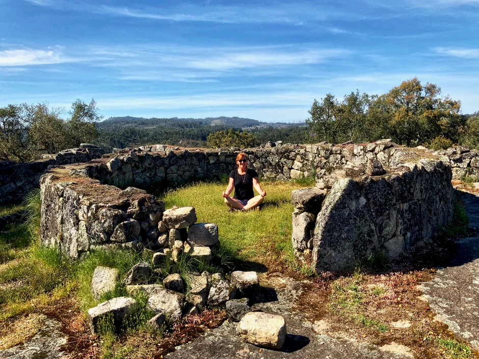
We arrived in the late afternoon when the soft light and shadows made the abandoned place a peaceful sanctuary. It was a welcome respite after the bustling charms of Lisbon and Porto.
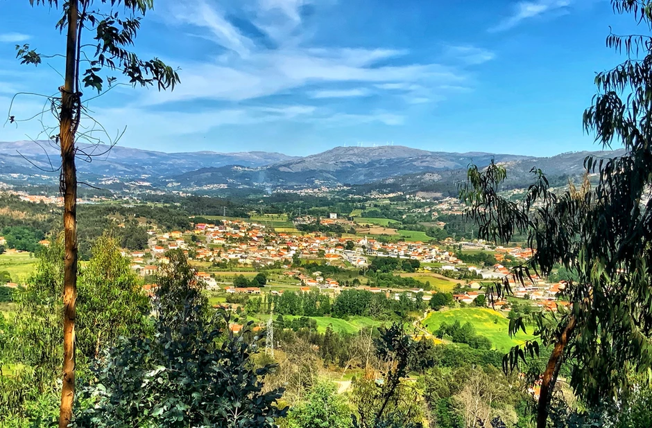
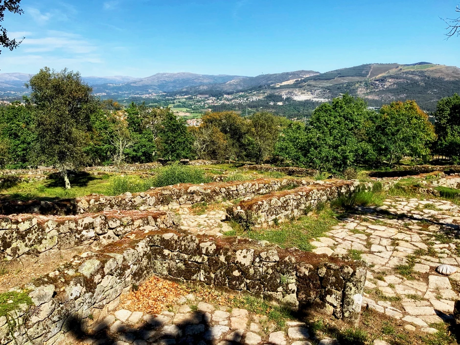
Citânia has a stunning view over the River Ave and the surrounding countryside. If you love old stones or loved Clan of the Cave Bear, this site’s for you.
Sarmento’s Hill Fort
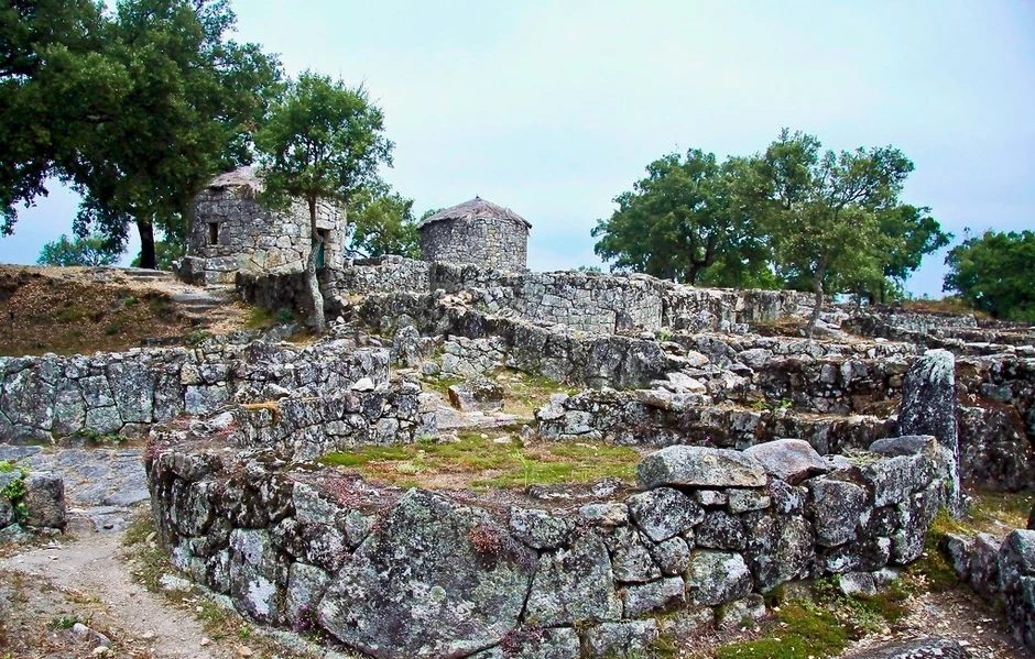
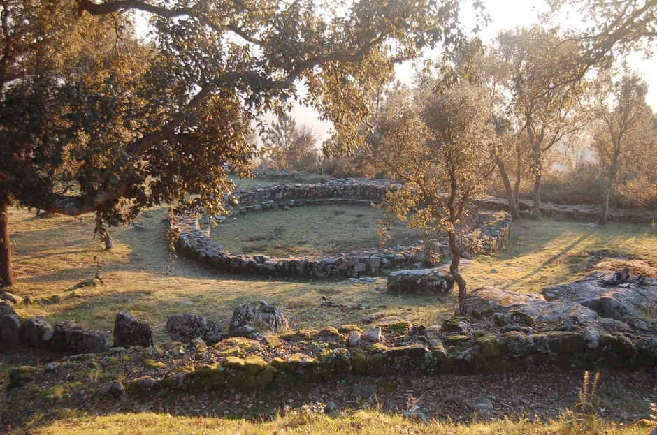
Citânia de Briteiros is a type of “hill fort” site called an oppidum.
It’s the largest of a scattering of porto-urban Celtic hill settlements called citanias, meaning fortified villages, on the Iberian Peninsula. The villages were situated on elevated grounds as a defensive tactic.
The site was likely inhabited between 200 B.C. and A.D. 300. It may have been the Celtiberians last stronghold against advancing Romans.
The site was the brainchild of Portuguese archaeologist Francisco Martins Sarmento.
Sarmento fell in love with the ruins and devoted his life to them. So intrigued was he by the site that he bought the land, started a research society, and later gifted his manuscripts and everything he owned to Portugal.
He made a difference in the world.
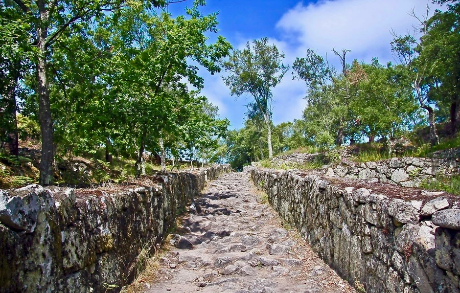
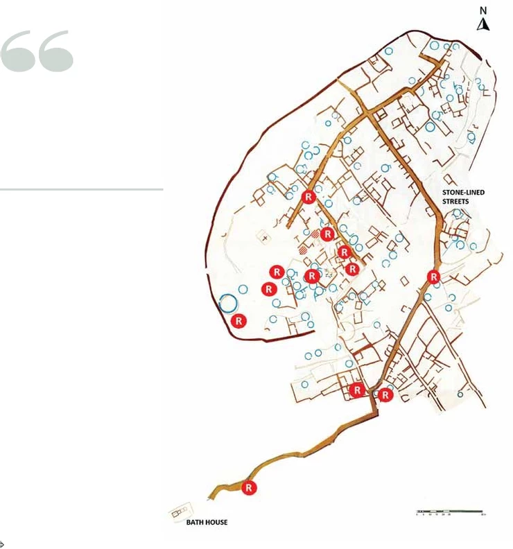
From 1874, Sarmento excavated the site annually. He discovered the ruins of more than 150 rectangular, circular and elliptical stone huts, linked by paved street grids and surrounded by protective walls.
A determined and obsessed Sarmento uncovered most of what is above ground today. He made a topographical study in 1892 and took pre-20th century photos.
In 1910, Citânia was listed as a National Monument.
For four decades from 1930-70, more excavations took place and restoration was completed. Experts estimate that approximately 100 hill forts were built there. To date, 50 have been unearthed.
The Reconstructed Huts
There’s a main road with several secondary roads. To the east, there are family compounds where rectangular constructions predominate. But they have different internal constructions. In each of these tiny huts, delimited by masonry walls, lived a large family.
The hill fort was surrounded by ramparts for defense, up to two meters deep in some places.
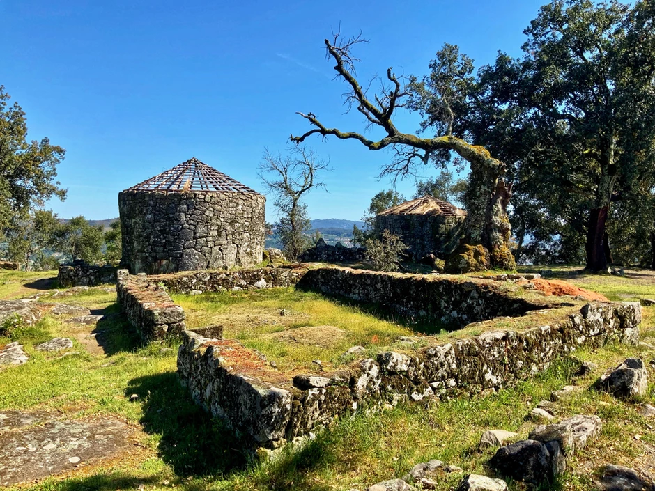
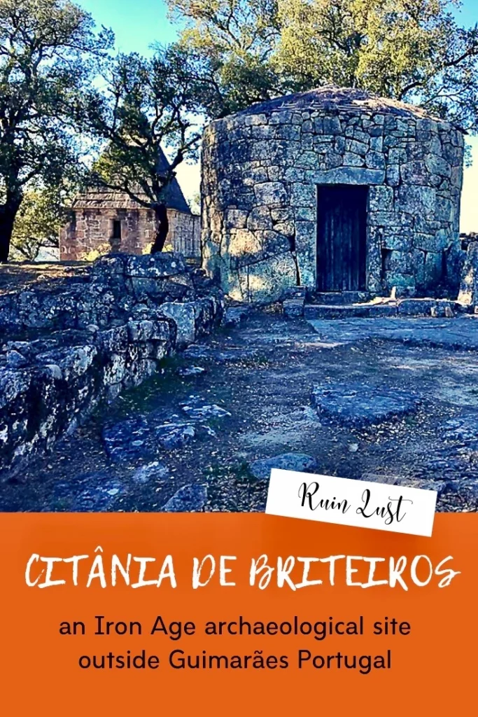
Sarmento reconstructed two of the huts to provide a facsimile of life in the Iron Age. I must say they look rather unappealingly as homes — primitive and cramped by today’s more spacious standards. The inhabitants must’ve lived mostly outdoors, not indoors, using the huts as a place to sleep.
Unfortunately, Sarmento was disappointed with his creations. He decided that the huts were unrealistically tall. He thought the doors should’ve been smaller and the thatched roof larger. But he left them as is.
Though they’re reconstructions, they’re a hundred years old already. And becoming antiques themselves.
There’s also a “council house” at the site, the largest circular building there.
Here, the hill fort leaders likely met to hash out problems, distribute communal tasks, and administer the community. There were also ceremonies held there.
In primitive and rather graphic fashion, powerful families showed their wealth by “immolating heads of cattle.”
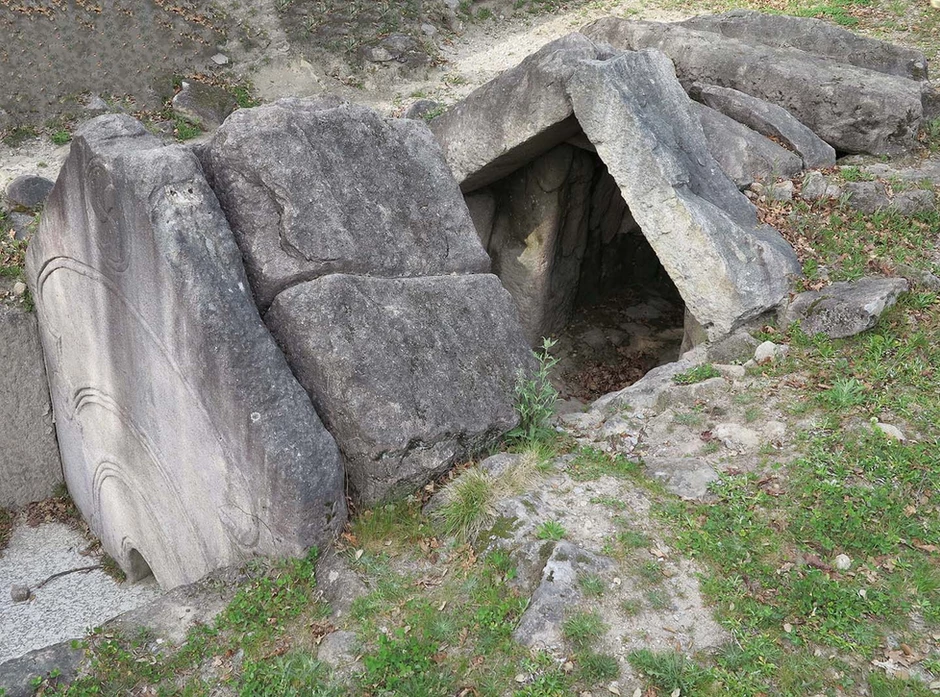
The Bathhouse
A bathhouse was discovered by accident in the 1930s during road work. For several decades, researchers thought the bathhouse was a crematory furnace. But new discoveries in the 1970s and 1980s showed that the structure was used for bathing and steam baths.
Water from the spring was fed into the bathhouse via a stone conduit. Steam was created by water being thrown over previously heated stones in the furnace.
It all sounds rather Roman, doesn’t it? From an uncivilized pre-Roman society.
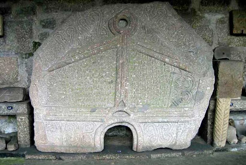
The bathhouse was even decorated.
One of the internal bathhouse walls, known as Pedra Formosa, the Beautiful Stone, is now housed in the Castro Cultural Museum in Guimarães. It’s a monumental slab of stone, standing almost six feet high, with a bas relief of a stylized human stick figure surrounded by symbols and designs.
A similarly shaped but less ornate large stone forms an in situ partition wall within the bathhouse complex on site.
Much “rock art,” mostly with abstract symbols, has been discovered in the settlement and on the surrounding hills. Some was even incorporated into the architectural structures there. The rock art has been removed and is in the Castro Cultural Museum.
Denizens of the Hill Fort
Who built this intriguing site?
Its origins are murky. Most experts believe Citânia was an early middle ages Celtic settlement, part of the first wave of Celtic expansion in Europe. Although Sarmento himself did not agree.
What makes Citânia distinctive from other hill forts is its large size. Based on current data, the population was between 500 and 1500, with possibly 150 families. They were self sufficient and engaged in trading. They had an actual economy.
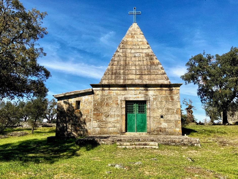
After the original population abandoned the place — whether from invading Romans or German barbarians — there’s evidence of further settlement from the 1st century A.D., probably Roman.
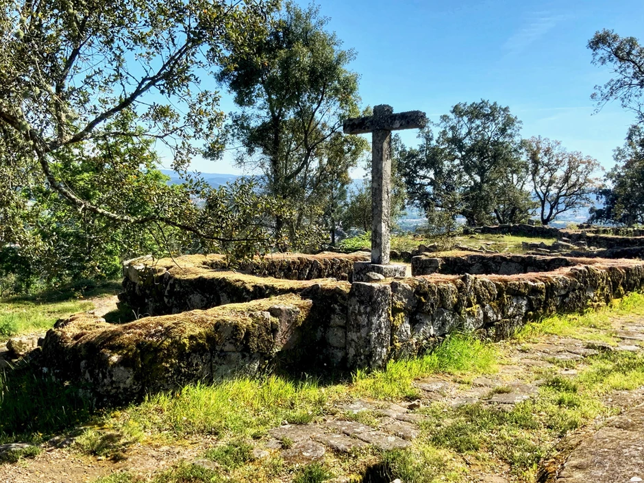
That latter settlement added a small christian hermitage, now reconstructed, and a graveyard.
The site is rather massive.
You could spend quite a lot of time hiking there. And it’s not the easiest of hiking. The “paved” roads consist mostly of massive uneven boulders. Don’t wear flip flops. Or you’ll be stuck between a rock and a hard place.
To fully appreciate the site, you should follow up with a visit to the Castro Cultural Museum, the Museu da Cultura Castreja in Guimarães. It’s housed in Samento’s former home. (Alas, we had to rock on and missed it.) There, you can see how advanced the pre-Roman civilization really was — silver, gold, pottery, stonework, and statues.
If you like old stones or need some profound peace and quiet, make a pit stop here. It’s a perfect day trip from Porto or Guimarães. You can appreciate the wideness of history and the world with nary a human in sight.
Practical Information for Citânia de Briteiros:
Address: Route N309 – Monte de Sao Roma, 14 Km from Guimaraes
Hours: Daily from 9:00 am to 5:00 pm
Entry fee: 3 euros
Pro tip: You really need a car to get to this off the beaten path site.
If you liked it, pin it!
Sabroso, a smaller castro a few Ks distance, dates to 800 bc, very sadly neglected and overgrown from when I first walked there summer of 1986. From highway building, trucks dumped dirt and till over the stairway and outer wall. Typical Portugal.